

|
|
|
|
 To
perform this operation each of the features, such as, clouds and shadows, and
build-up areas needed to be subset. Below left, are the subsets of the
clouds and shadows, and below right, are the cities and. To
perform this operation each of the features, such as, clouds and shadows, and
build-up areas needed to be subset. Below left, are the subsets of the
clouds and shadows, and below right, are the cities and. 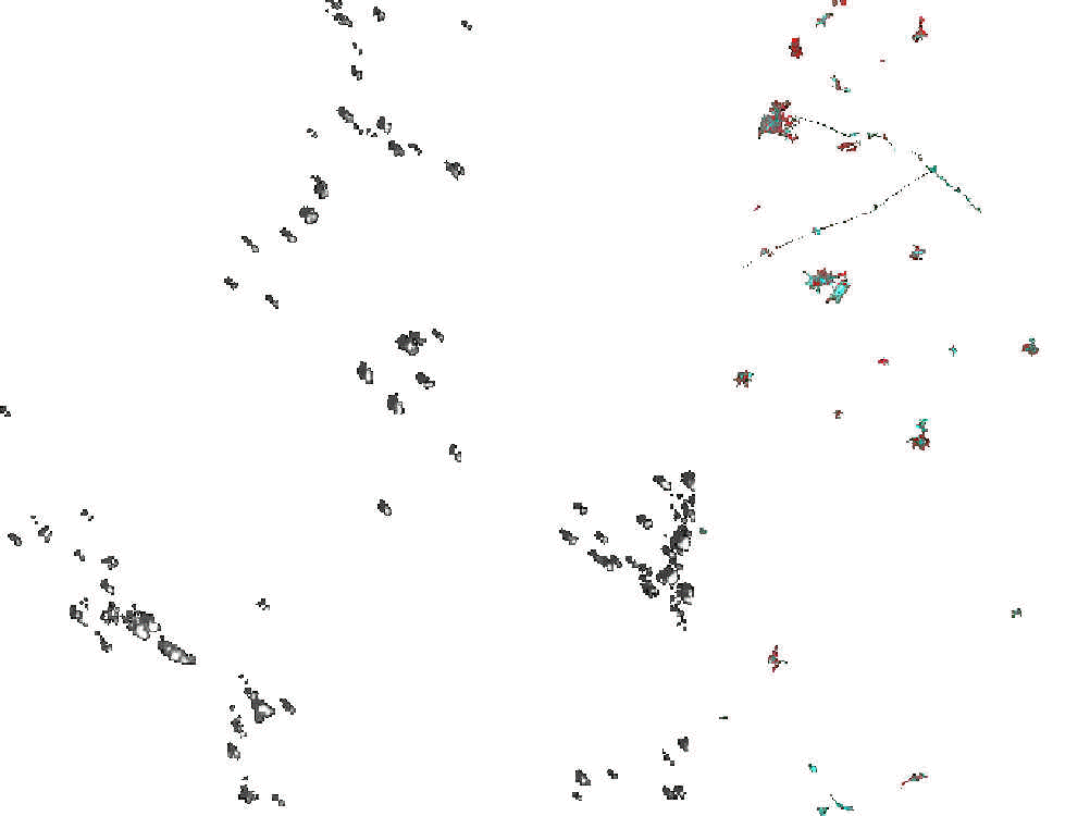
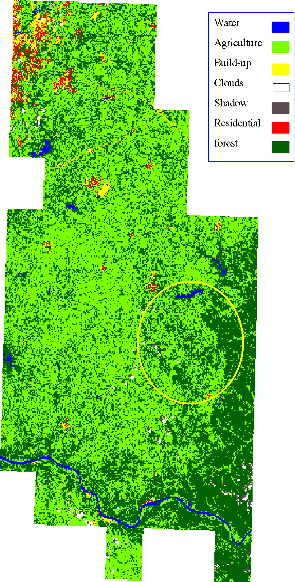
These were classified separately from the original image to reduce problems with miss classified values. Next, I ran 175 classes for the Unsupervised Classification. Again, each of the three components were classified separately with 175 classes. I chose this many classes to differentiate as much as possible. Next, choosing the number of classes was a task that needed ground truthing data to help aide this process. Due to time constraints, I chose to classify the major components within the image to reduce user errors. Since, I have not been to Southern Ohio to ground truth (but this will be done this summer), I chose general landscape features like, Agricultural land, Forest, Water, Residential, Build-up (commercial, industrial), Clouds, and Shadows. The classified image on the right depicts the individual components associated with the subsets and remosaic process. If you mouse over the yellow circle, the link will take you back to the Purpose page. That image was derived using a DEM and the classification. The circle shows the mounded features in which we think are the best possibilities for finding the eroded basin features for our study. |