Detection
of vegetation changes using Landsat 7 NDVI:
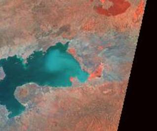
Nyando River Basin
Kenya,
East Africa
Kari
Gerwin
University
of Toledo
Department
of Geography and Planning
Introduction
Upon noticing the massive sediment loading into Lake Victoria’s Winam Gulf, the Nyando River Basin, which drains into the gulf, was selected
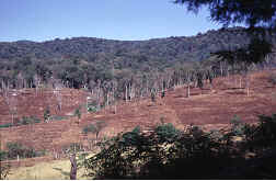
as a remote sensing study area. Much of the basin has a history of
deforestation for fuel wood, mining, grazing and agriculture as well as other
land-degrading practices. The purpose of this research was to use NDVI to
identify areas that show the most severe loss of vegetation to find possible
sources of erosion and sediment loading in the Winam
Gulf. Problems associated with vegetation loss and deforestation include loss of terrestrial habitat and loss of soil
nutrients, resulting in nutrient enrichment of waterways and high algal growth.
Vegetation changes on land effect littoral habitats by promoting erosion and
filling littoral zones with fine and coarse sediments, thus altering habitats
of littoral species. Socio-economic effects of vegetation loss and sediment
loading are numerous. These include reduced agricultural and fishing
capabilities. The World Agroforestry Center has identified the Nyando River basin as a main contributor of sediments to Lake Victoria.