Results:
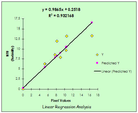
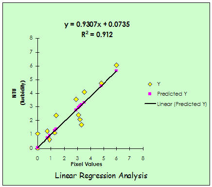
The linear regression
model yielded a good relationship between the in-situ data and satellite
pixel values. The model for July 16, 2002 yielded an R2 of
0.93,(Fig.5) and an R2 of 0.90 (Fig.6) for August 01, 2002 image.
This indicates that LandSat 7 ETM + Could be used to remotely
sense water turbidity. The present results could be used to develop water
quality maps .
The spatial nature of the
water quality maps allows the resource manager to have a snapshot in time of
the water conditions over an entire lake or reservoir. These maps can be
used to document baseline conditions, determine areas of significant point
or non-point source water pollution, or document the affect of management
activities intended to improve lake water quality.