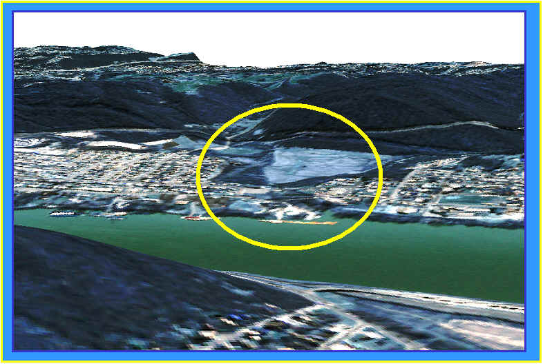
| Home | Introduction | Methods | Results | Conclusions |

3D Visualization allows the planner to verify that a probable infill site is indeed fit for development.  Virtual GIS is useful here.  To the right the, the area classified as bare ground is on a relatively flat surface.  Medium density neighborhoods surround this area adding to its attractiveness as an infill area. 

Here is an area that appeared to be perfect for infill when classified, but when compared with the 3D model it is obvious that this hilltop is not an ideal place for urban development. Without 3D VirtualGIS this aspect would have been difficult to detect.