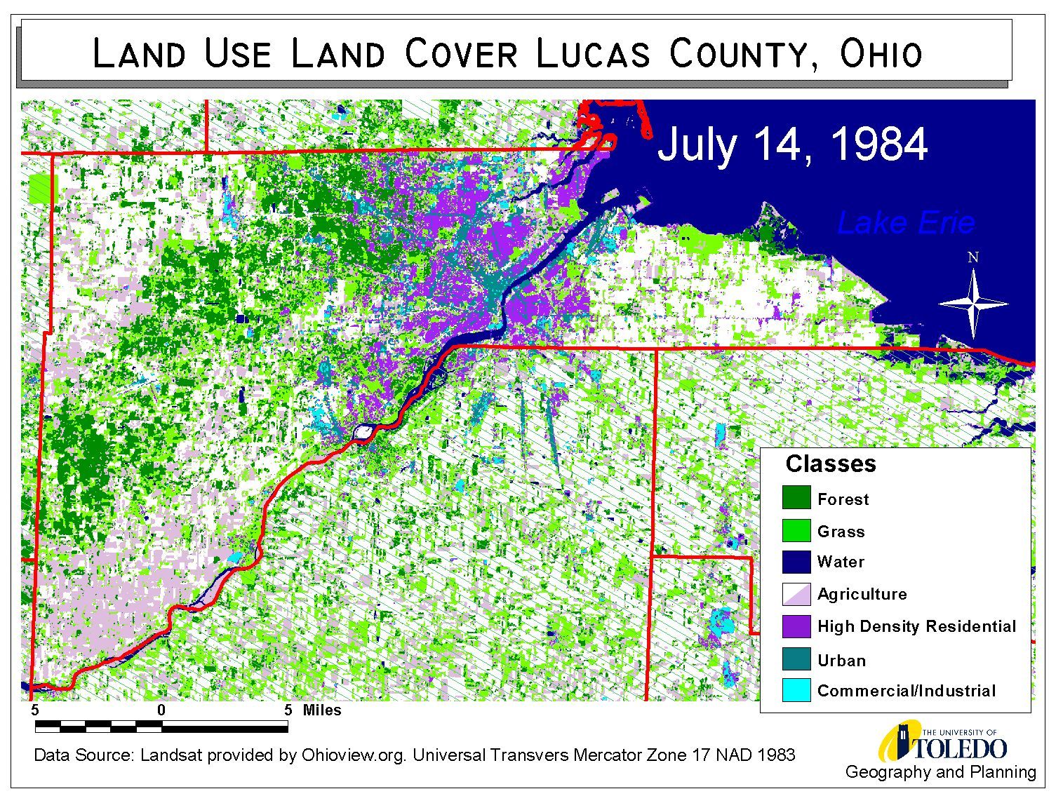
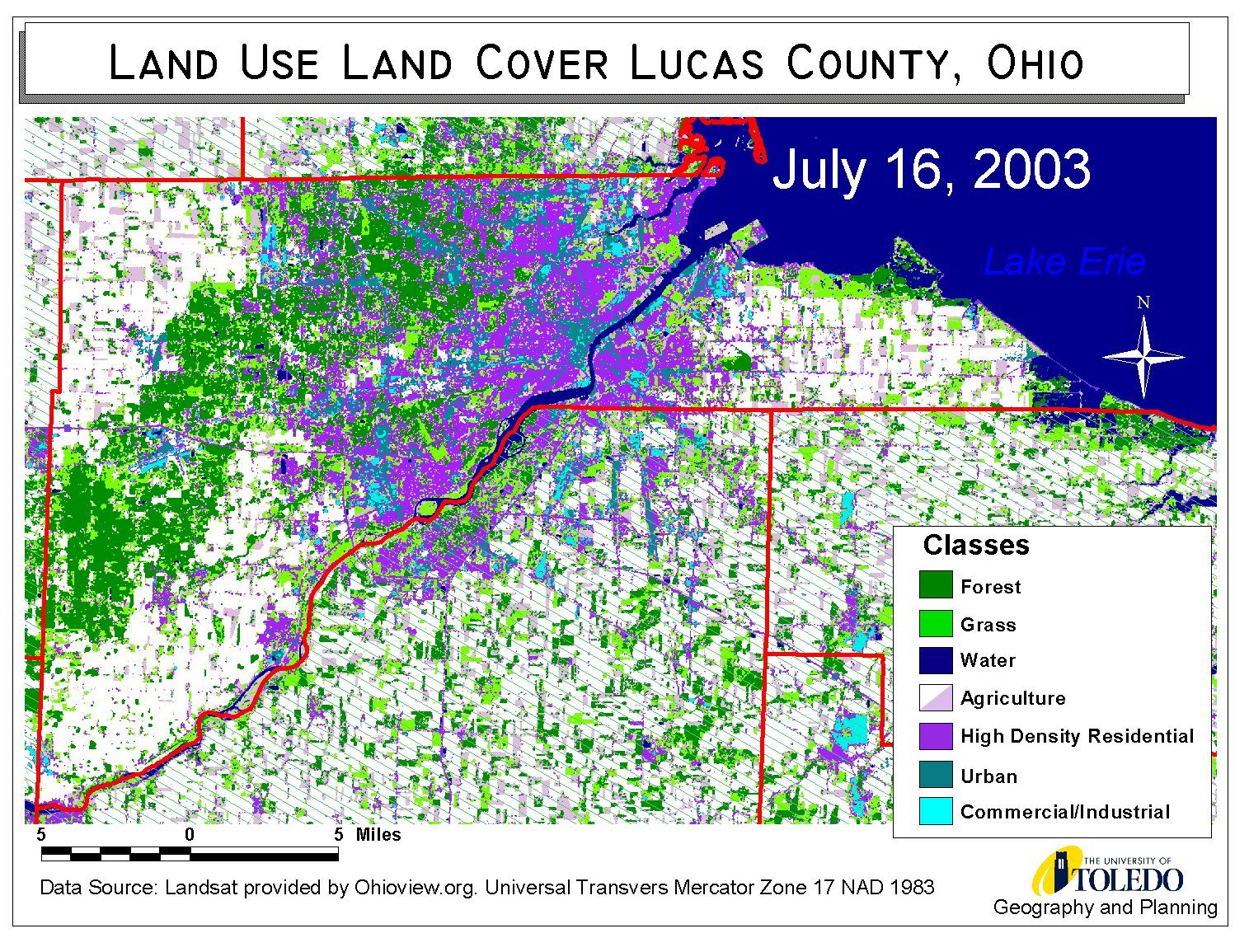
Land Use Land Cover for Lucas County, Ohio 1984 & 2003
Click on the image to reveal the transition
Lucas County, Northwest Ohio is dynamic and changing region. Land use and land covers vary a great deal within the county boundary. Both heavy industrial land uses and intensive agriculture land uses are found within boundary Lucas County. Toledo, Ohio is roughly located in the center of the county. It is an aging industrial center that suffers, as many cities in the region do, from a diminishing central business district in conjunction with increasing suburbanization. As suburban land uses move further from urbanized city and into the rural-agricultural regions land use land covers transform. These shifts may be observed in the maps below. The large oak savanna called Oak Openings is found to the west of Toledo cutting through the county in a Northeast to Southwest direction, the Toledo Express Airport is located in the center of the Oak Opening preserve. These maps were made at the University of Toledo’s Department of Geography, in conjunction with the Research Experience for Undergraduates program (a National Science Foundation project, SES0243872, in its sixth year at the University of Toledo) at the Lake Erie Center. Satellite images provided by the Ohioview.org project supplied the necessary image data with which to construct these maps.
Known features were located in the imagery and used to train a supervised classification for the two years 1984 and 2003. This process essentially assigns each pixel in the image to a certain class based on the pixel’s brightness values in six Landsat bands (band 6 was not used). Landsat, the satellite images used for this project, produces a multi-spectral image. These classes are then used to create the maps shown here. Accuracy assessments made on the two images using standard error matrix techniques show that the classification based on these classes has an accuracy of 90%.
These images are provided for your use. When using these image you are asked to please cite the University of Toledo’s Department of Geography and Lake Erie Center as the author of these maps. Special thanks goes to the REU student Michelle Roy from Salem College for her excellent work on these image processing.